 Campigna is reached from Firenze following the highway "Tosco Romagnola"
until Pontassieve and from here the highway Passo della Consuma. Arriving
at Poppi, climb with the highway n.310 towards Pontvecchio and Stia and
from there to "Passo della Calla and to Campigna. From Forli it is
sufficient to follow highway n.310 which, going through "Galeata
and S. Sofia, reaches the starting point.
Campigna is reached from Firenze following the highway "Tosco Romagnola"
until Pontassieve and from here the highway Passo della Consuma. Arriving
at Poppi, climb with the highway n.310 towards Pontvecchio and Stia and
from there to "Passo della Calla and to Campigna. From Forli it is
sufficient to follow highway n.310 which, going through "Galeata
and S. Sofia, reaches the starting point.
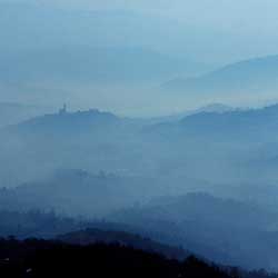
An itinerary among the most interesting from a naturalistic point of view,
as most of it is covered in the National Park of the Casentinesi, Campigna
and Monte Falterona Forests. Above all the first part between Campigna
and the Passo della Calla takes place in one of the most beautiful corners
of the protected area, among the centuries old and columnar silver firs
of the Campigna forest. To note as well, that the road which you follow
represents the ancient road that from Corniolo climbed to Passo della
Calla, a road which passes by the "Viale dei Tigli" (the avenue
of the lime trees), one of the most dearly loved places of Dino Campana.
Leaving the car in the car park at Campiglia, go down between "the
quandrangular houses built by Lorena in living stone", pass in front
of the little factory which houses the forestry museum to reach a fork
in the road. Here you take the left road and by doing so you get onto
the "Viale dei Tigli" passing inside that which could be described
as one of the most majestic green tunnels of the Apennines. At the end
of the avenue it will be possible to continue on the old road for Corniolo.
If, instead, you want to go to Stia you must retrace your steps and go
beyond the car part climbing on foot along the tongue of asphalt which
takes you to the highway (towards Firenze).
A little before you reach this, on the left, you find the pathway n.37
(wooden arrows) which takes you to Passo della Calla. The mule track goes
straight into the woods crossing a little wooden bridge and thence starting
to climb. Going along "interminable woody and deserted valleys"
on the mule track which finds its way among columnar silver firs, you
touch on the highway and then, with a last effort arrive at the Calla
pass. From here leave the asphalt to take, on the right, a large unsurfaced
road closed by a bar (pathway n.80 CAI) which enters into the Beech Woods
which cloak the sloping Tuscan passes. After only a few hundred metres,
at a fork in the road, go left and in doing so reach the Sorgente Calcedonia
an extremely fresh spring noted for the quality of its water. Here, turn
right on the asphalt and go down for a few hundred metres and then follow
the white/red signs for the CAI pathway on the right which lets you cut
out several turns in the highway. Return to the latter, and follow it
for 200 metres then take, on the right, a road closed to cars by a bar
(pathway n.80). From here on you do not cross the highway again and all
the route continues inside the woods, sometimes Beech, sometimes Firs.
In particular, attention must be paid to the first fork, where you go
right and a successive junction where you go straight ahead. Follow the
pathway, slightly overgrown, which borders the Fosso Gorgone , it is possible
to descend until the cart track which takes you to the highway is reached.
To reach Stia, "white and elegant amid the green, harmonious with
peaceful castles" you just follow the asphalt (those who wish, however,
can avoid the last tract by immediately taking the road to return to Campigna).
| Time required |
6/7 hours |
| Vertical height |
970 m |
| Maps |
Multigraphic 1 :25.000 n. 33-34 |
|
 Skiing round the Apennine hermitages
 Photo Gallery: The tour