| 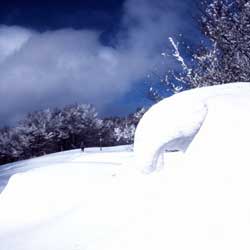 A
route with various points of interest –besides the two hermitages,
the valley of the Torrente Acqua Cheta is very attractive and there are
also the spectacular Acquacheta waterfalls. A
route with various points of interest –besides the two hermitages,
the valley of the Torrente Acqua Cheta is very attractive and there are
also the spectacular Acquacheta waterfalls.
The route does not begin precisely at the Passo del Muraglione; from the pass
you have to descend towards Dicomano and Florence for about 1 km, until you come
to a brown sign on the right indicating “Fiera dei Poggi”. Leave
the car here, put on your skis and set out along the wide track that runs just
beneath the ridge and cuts across the slopes of the Fiera dei Poggi to Colla
dei Lastri. The route is quite clear; carry on along the main track, which keeps
to an altitude of over 1000 metres, cutting across the slopes of Poggio Erbolini
to Colla della Maestà (four kilometres). The saddle, which is grassy with
a few bushy beeches, is crossed by the GEA path (the red and white signals are
visible even in the snow). However, do not follow this but continue along the
main route which now descends gradually along a secondary Apennine ridge. This
soon brings you to Il Crocione, where the path for the hermitage of S. Maria
goes off to the right. If the snow and temperature conditions are not ideal (remember
that to reach the Romiti you need to cross a small river a number of times and
this needs to be frozen), the itinerary can be completed by going to the hermitage
of S. Maria, located in a visible position in the centre of an open field. Otherwise,
continue along the main route which, after a final, virtually flat stretch, begins
to descend quite steeply towards the Fosso dell'Acqua Cheta. When you get
to the bottom of the valley, bend right, following the course of the stream but
then crossing it almost immediately for the first time. The route then recrosses
the stream and some of its tributaries a number of times and finally arrives
at the open expanse of I Romiti, where the monastic complex is situated. From
here it is not far to the waterfall of Acquacheta, a fabulous sight in winter.
But the path leading to the falls can only be attempted on foot, so the snow
must not be too steep. From I Romiti, return to the Muraglione the way you came.
| Distance |
21.5 km (round trip) |
| Difference in height |
450 m |
| Time |
5.30 hours |
| Level of difficulty |
Easy as far as the hermitage, medium difficulty
in the descent to the Romiti |
| Map |
Multigraphic 1:25.000 n.25-28 |
| Suggested period |
January/February |
| Rest point/accommodation |
Albergo al Muraglione, tel. 055/8374019 |
| Getting there |
The Passo del Muraglione can be reached
from Florence and Forlì along the Toscoromagnola SS. no. 67. |
|
 www.terraditoscana.com