|
 Inhabitants in 1991: 692
 The
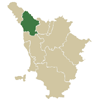
municipal territory of Fosciandora extends for 19,82 square kilometres
on the left slope of the middle valley of the Serchio, in an elevated
position dominated by the Appenninica chain on the shoulder of the settlement,
and opposite the Alpi Apuane. The
municipal territory of Fosciandora extends for 19,82 square kilometres
on the left slope of the middle valley of the Serchio, in an elevated
position dominated by the Appenninica chain on the shoulder of the settlement,
and opposite the Alpi Apuane.
Formed, other than the Capital by five districts, the municipal territory
has seen extremely active historic events. After having been part of the
Lucca dominion, as shown in a citizens statute of 1308, in precision
from the Vicariate of Castiglione di Garfagnana, it was divided in
1451 between the two bordering States: the centres of Lupinaia, Riana
and Treppignano remaining with Lucca while those of Migliano, Fosciandora
and Ceserana (castle belonging before the year 1000 to the Rolandinghi
family) passed to Firenze and then in 1451 to the Duke of Ferrara Borso
d’Este, thus constituting the Vicariate of the Terre Nuove.
The unity of the territory was reconstituted in 1846 with the creation
of the municipality of Fosciandora.
Historical info reproduced upon authorization of Regione Toscana - Dipartimento della Presidenza E Affari Legislativi e Giuridici
Translated by Ann Mountford |