|  Inhabitants in 1991: 8.870
 Situated
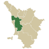
in the Valdarno which dominates the Arno plain, the municipal territory
extends on a hilly and plain land for 29.96 square kilometres. The
municipality has Leopoldino origins, and suffered territorial variations
in 1927 when the districts of Castel del Bosco and Marti were aggregated,
having been part of the municipality of Palaia, and a portion of uninhabited
territory was detached and aggregated to the aforementioned municipality. Situated
in the Valdarno which dominates the Arno plain, the municipal territory
extends on a hilly and plain land for 29.96 square kilometres. The
municipality has Leopoldino origins, and suffered territorial variations
in 1927 when the districts of Castel del Bosco and Marti were aggregated,
having been part of the municipality of Palaia, and a portion of uninhabited
territory was detached and aggregated to the aforementioned municipality.
Montopoli’s history is interwoven with that of the destroyed
parish church of San Peiro a Musciano, which was heard of from 746.
Around the year one thousand the castle was under the civil and Ecclesiastic
jurisdiction of the Bishops of Lucca, who retained it successively,
even though until the end of the XII century a series of Imperial certificates
had settled the high dominion of that territory on the municipality of
Pisa. Object of continual controversy because of the armed disputes
between Lucca and Pisa, it passed alternatively from one dominion
to the other until 1325 when it rebelled against Castruccio Lord
of Lucca, and subjugated itself to the Firenze republic, who made
it into one of the strongest military outposts of its coastal district.
After a brief period of domination by Pisa in 1347-49, Montopoli was again
taken over by Firenze and became Vicariate Seat of the Valdarno di
Sotto until 1370 when the magistrature was transferred to San Miniato.
It shared the fate of the Grand Duchy until the Unity of Italy.
In 1863 it added the denomination of “in Val d’Arno”.
In 1944 it suffered the destruction of the Medieval fortress by the
Germans.
Places to visit:
S.Stefano, church which has an ancient crenelated tower as
its bell tower. The interior of the buildings holds numerous precious
works of art from the 15 and 1600s. |
Historical info reproduced upon authorization of Regione Toscana - Dipartimento della Presidenza E Affari Legislativi e Giuridici
Translated by Ann Mountford |